Mangrove Maps
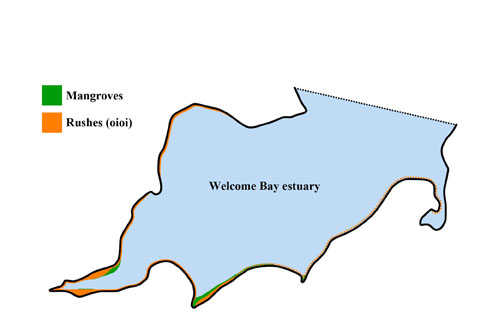
Extent of Mangroves in the Welcome Bay estuary in the 1970s
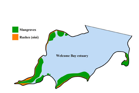
Extent of mangroves by the late 1990s, limited by human intervention
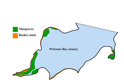
Extent of mangroves after the 2011 removal of mangroves by machine
WHAT IF?
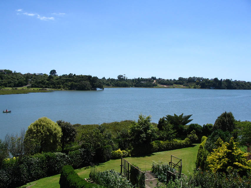
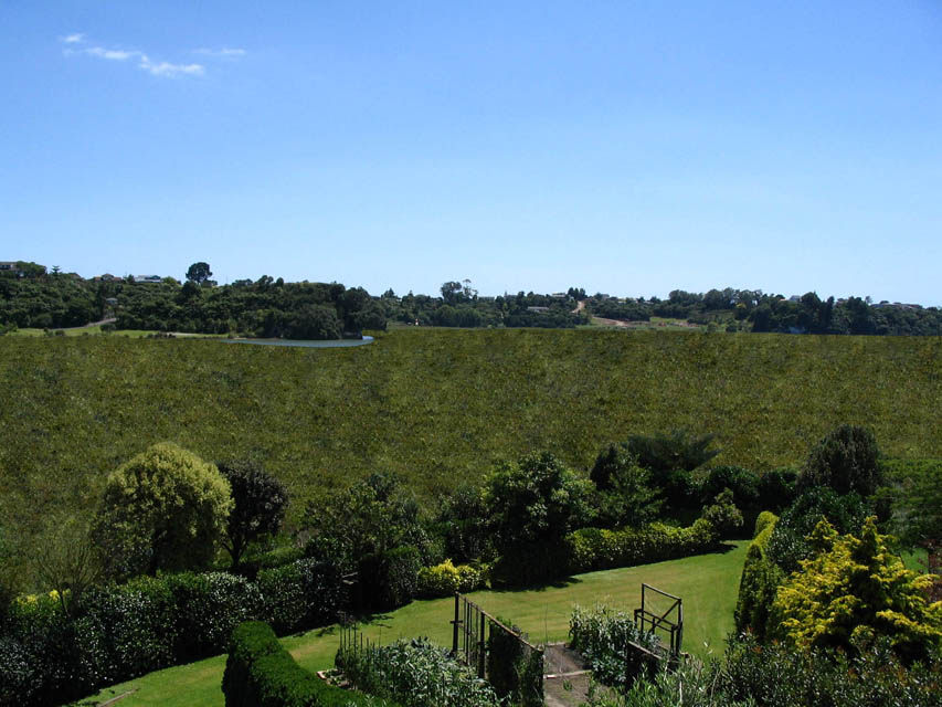
The first photo below shows a portion of the Welcome Bay estuary as it appears after the efforts of local residents during the 1980s and 1990s had halted the rapid spread of mangroves during this period of time. The second photo is computer generated and shows how this same portion of the estuary would have appeared if local residents had not acted on their own initiative in the 1980s and 1990s but had instead waited for the decisions and rulings of local Councils or of Environment Court judges. The photos illustrate how the democracy of common sense has benefited the community.
A few years ago the editor of the Weekend Sun made an observation to the effect that the extent of the mangroves in the Tauranga Harbour did not seem too bad to him. One might be forgiven for thinking that he was oblivious to the many hours of hard work spent by a small number of residents keeping the mangroves in check and preventing them from taking over large areas of our estuaries.